

Beheira Governate Water network modelling using Water CAD
About The Project
Project Name : Beheira Governate Water network modelling using Water CAD
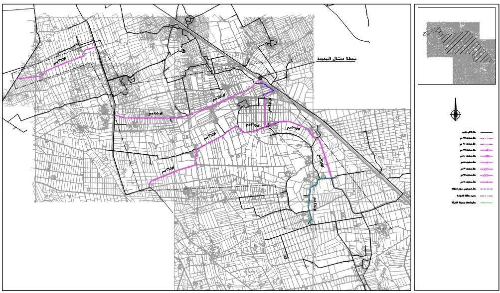
Project Details : Beheira Governate Water network modelling using Water CAD to model variance pipes diameter from 100 mm to 1000 mm
Project Description :
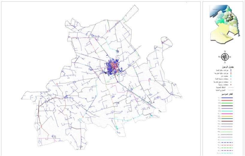
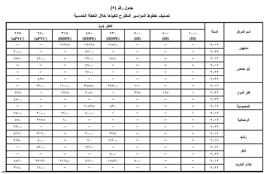
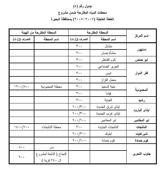
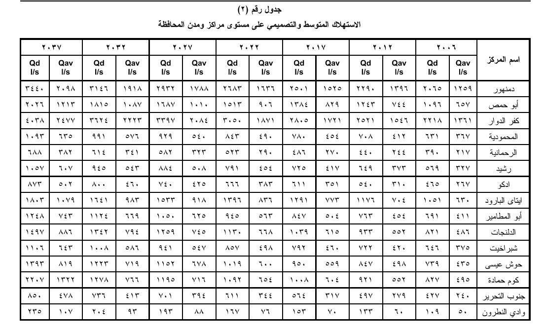
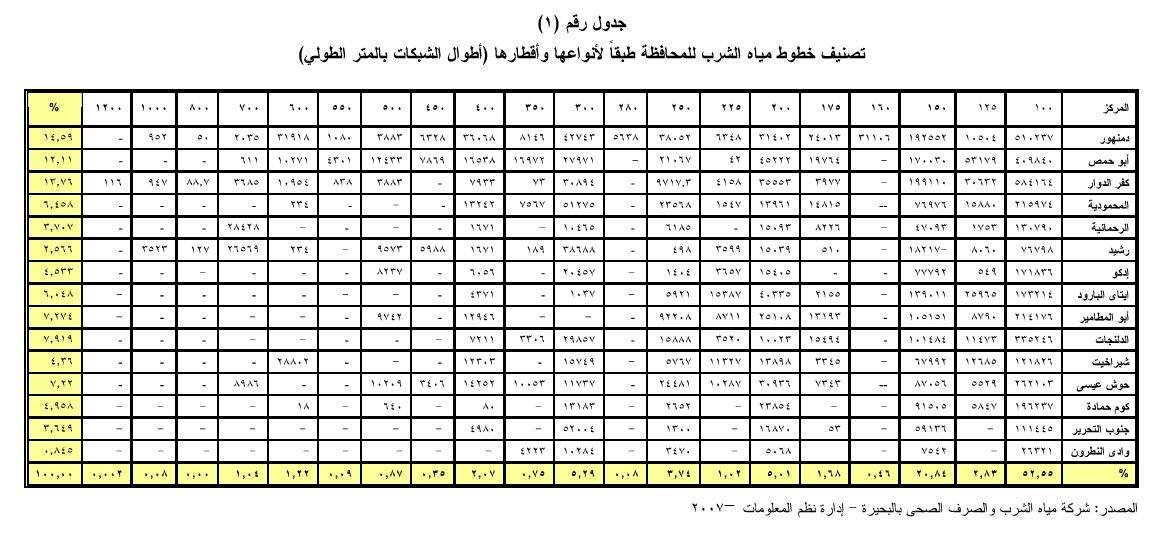
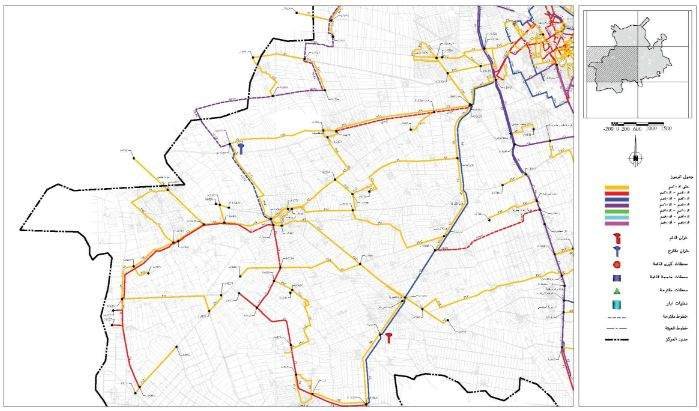
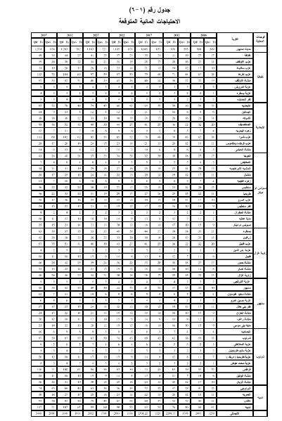
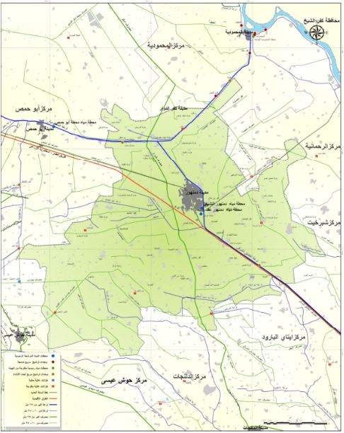
The project involved using the WaterCAD program to model the water network of Beheira Governorate, which included over 50,000 water pipes and 18 pumping stations. During the project, we performed network calibration, identified low-pressure areas, and proposed improvements. A significant challenge was coordinating between different departments, such as GIS and the meter management department, to ensure data accuracy. We faced issues like inaccuracies at network intersections and overlapping pipeline segments, which required thorough verification. We utilized ArcGIS to extract data and work with WaterCAD for modeling, ensuring the accuracy and consistency of the data.